
ICU Aerial Photo
The Collection of the aerial photographs of ICU Mitaka Campus from various eras, 1949 to1990's
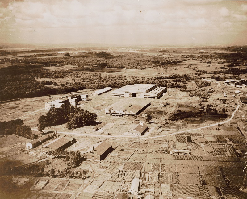
Campus Center (1949)
The picture taken sometimes between Nakajima Aircraft Co had left and ICU purchased the land. In the center is the sheet metal factory. On the left is three-story building later renovated to the University Hall. The largest building is the hanger. We can see the Tama Cemetery in the background.
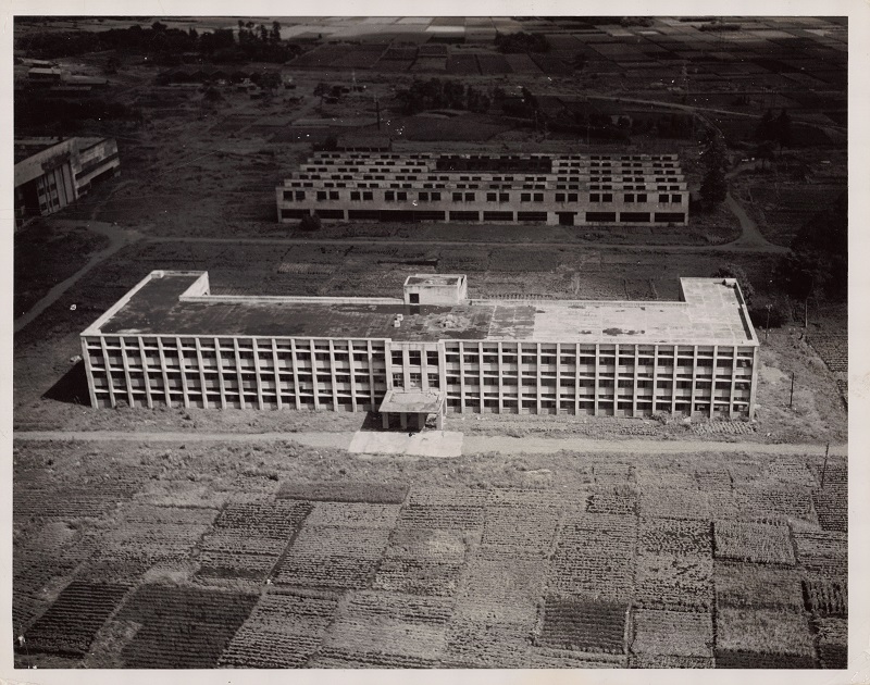
The University Hall (1949)
The University Hall (Honkan) before ICU came. The fourth floor was later added by ICU. In the background is the sheet metal factory. Bakayama space was cultivated by the farmers return to their own land after Nakajima Aircraft Co. left the site.
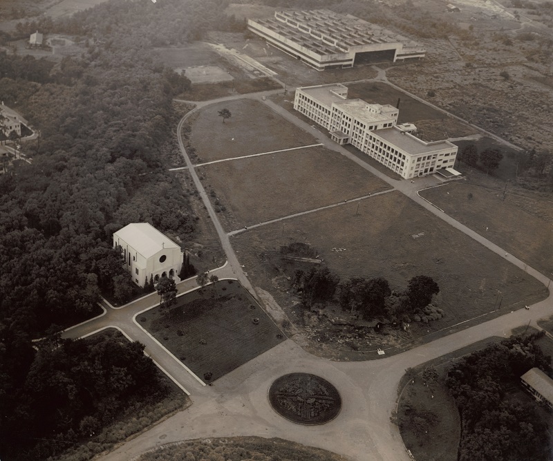
The Campus Center (1956)
The view from the south-east. No Bakayama is observed in front of the Honkan. The Library is yet to be built. In front left is the first chapel designed by an architect Merrell Vories in 1954. The giant hanger is still in the background.
The Campus Center (1956)
The view from the south. The buildings in front, from the left are: The Maple Grove Apartment, The First Women's Dormitory, The Cafeteria, The First Men's Dormitory.
The Distant View of the Campus (1956)
The view from the south. The Nogawa river and rice paddies is seen in the near side. The one on the right could be the wasabi fields. The housings in the far end later became Mitaka-Iguchi apartment.
The Distant View of the Campus (1957)
The view from the south. Two flat-top three-story buildings are the Second Women's Dormitory (left) and the Second Men's Dormitory (right). The hanger is being deconstructed.
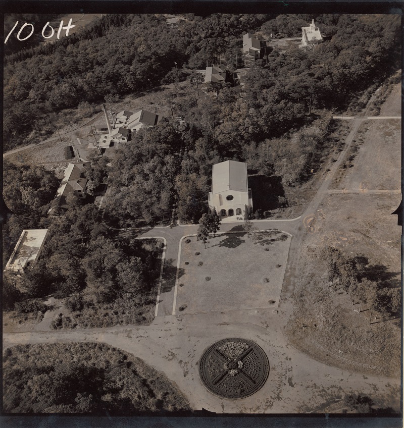
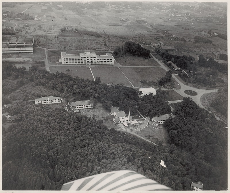
The Rotary and the Chapel (1957)
The view from the east. The old rotary was constructed by Nakajima Aircraft Co. and inherited by ICU. X-shape shrub was probably designed by ICU. The cafeteria was extended in the same year, and the Diffendorfer Memorial Hall was build next year behind the chapel.
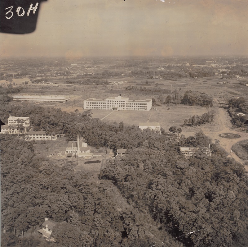
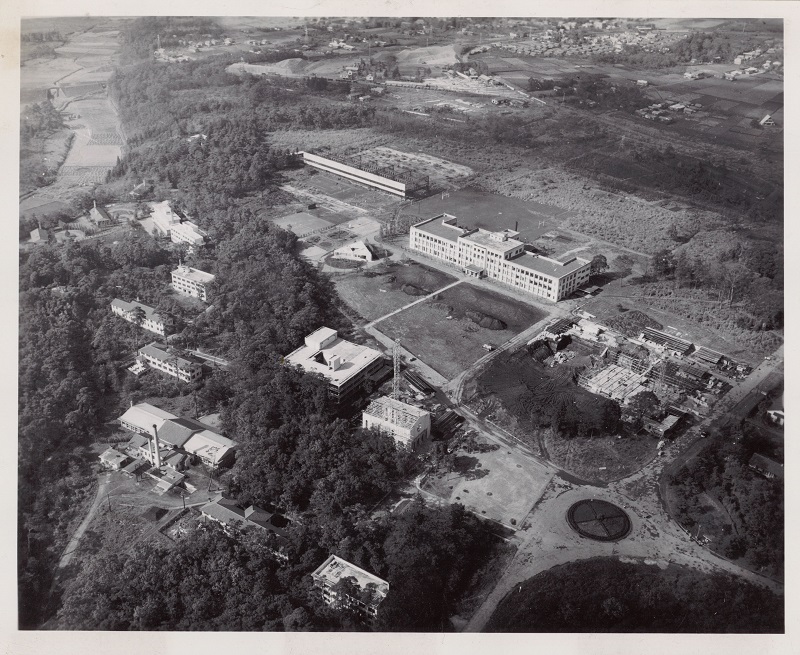
The Campus Center (1959)
The view from the south. The Third Women's Dormitory (left,) The Diffendorfer Memorial Hall (center,) Seabury Memorial Chapel (triangular building) was completed. We see a flower bed behind the Seabury Chapel. The university cafeteria is extended to both sides. In the background is the remains of the service line branching from the Seibu Tamagawa Line. It extends to the east end of the later ICU Highschool site.
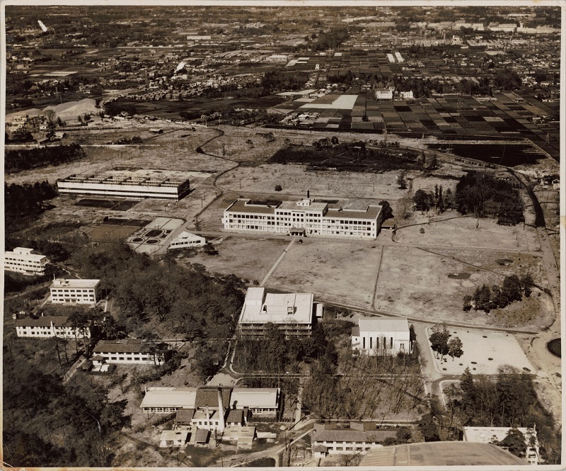
The Campus Center (1959)
The view from the south-east. The first chapel is about to be deconstructed by an architect Antonin Raymond. The soil dug out of the Library construction site is forming Bakayama. The hanger is under deconstruction. The tree standing on the right of the University Hall is the memorial tree planted on September 6th, 1951, commemorating the signing of the San Francisco Peace Treaty, later relocated to the Library front yard.
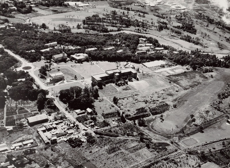
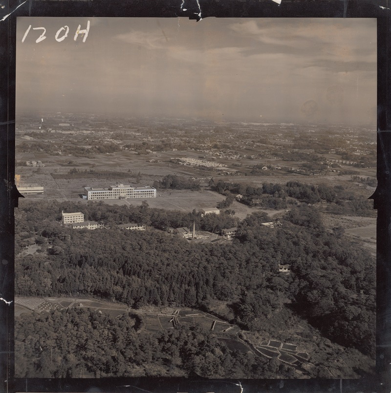
The Campus Center (1964)
The view from the north-east. The ICU farm was closed and the ICU golf course opened this year. It covers the area of the present Nogawa park to the present ICU Highschool. The chapel has been refurnished in 1960 to what we see it now. In far end on the right is the American School in Japan moved here from Meguro in the previous year. The plum trees on Bakayama will be planted a year after this year. The memorial tree for the San Francisco Peace Treaty has been relocated to the Library front yard.
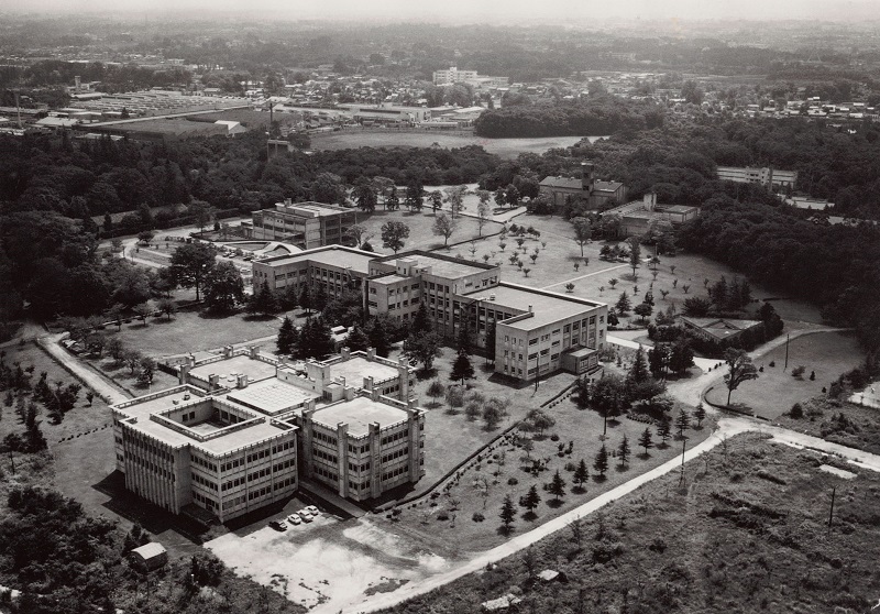
The Campus Center (1970)
The view from the north-west. The Science Hall was completed in 1966. Himalayan cedar trees planted along the lane ware cut down for building the Troyer Arts & Science Hall. The Bakayama plum trees planted in 1966 look about 5 to 6 feet tall. The Library extension work took place a year after this. The curved lane between the Seabury Chapel and the tennis court was made straight after this.
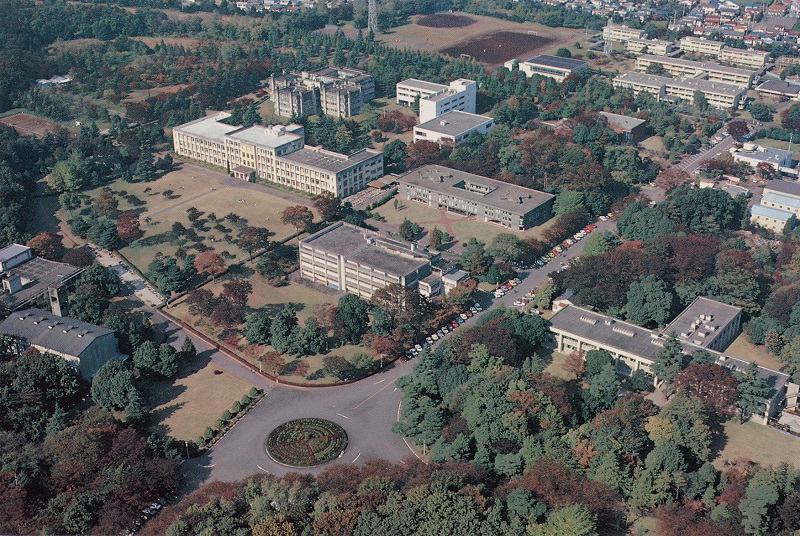
The Campus Center (1983)
The view from the south-east. On the right far-end is the ICU Highschool opened in 1978. The Administration Building was constructed in the same year. The small building behind it is the East Grove Apartment, one of the few heritage front the Nakajima Aircraft Co. that was refurnished by ICU for teachers' housing. It was here at least until 1987. The golf course was sold to the Tokyo Metropolitan Government and was converted into the Nogawa park. There were no independent parking slots. The road between the Chapel and the Highschool was used to park the cars.